Description
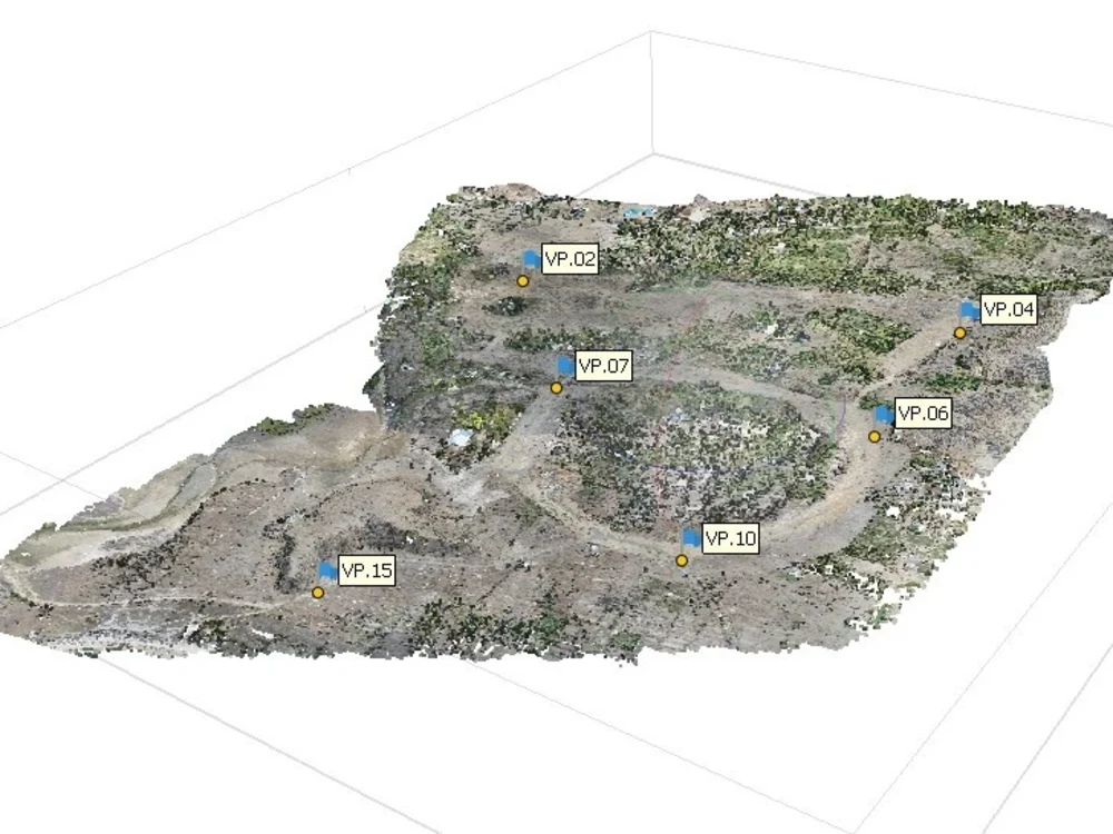
Construction planning requires precision, and our Digital Site Mapping & Surveying service delivers accurate virtual assessments for site development. Using cutting-edge mapping technology, we generate high-resolution site plans, topographic data, and 3D visualizations. This service eliminates the need for frequent on-site visits, saving time and resources while improving accuracy. We provide detailed reports on land measurements, terrain conditions, and structural planning insights, helping contractors make informed decisions. Whether you’re assessing land for new construction, remodeling an existing structure, or planning large-scale developments, our digital mapping tools provide the accuracy and efficiency needed for precise project execution. With real-time data and cloud-based access, your team can collaborate seamlessly while reducing project risks and errors.

Ayodele –
“Digital Site Mapping & Surveying has been an invaluable tool for our construction projects. The virtual assessments using advanced mapping technology allowed us to accurately measure land, visualize sites in 3D, and plan projects with precision, eliminating the need for physical visits. The precise measurements and data provided by the service enabled us to make informed decisions, ensuring efficient and accurate construction.”
Tawa –
“Digital Site Mapping & Surveying’s virtual construction service has been an invaluable tool for our project planning. The ability to conduct assessments remotely has not only saved us time but also significantly reduced the risk associated with physical site visits. The precise land measurements and 3D site visualization provided us with an unparalleled understanding of the site, allowing us to make well-informed decisions and minimize potential setbacks. We highly recommend this service for anyone looking to enhance their construction planning process.”
Halimatu –
“Digital Site Mapping & Surveying’s virtual assessment service revolutionized our project planning. The accurate land measurements and 3D site visualization allowed us to pinpoint potential construction challenges and plan accordingly without disrupting the environment or requiring physical site visits. This virtual approach was not only efficient but also provided invaluable insights, enabling us to make informed decisions and minimize construction delays. We highly recommend this service for any project seeking cost-effective and precise construction planning.”
Oluwakemi –
“After using Digital Site Mapping & Surveying, I was thoroughly impressed. Their virtual assessments eliminated the hassle of physical site visits, providing me with precise land measurements, immersive 3D visualizations, and invaluable project planning insights. The accuracy and convenience of this service transformed my project execution, enabling me to make critical decisions confidently. Digital Site Mapping & Surveying has revolutionized my construction approach, and I recommend their exceptional virtual service to anyone seeking precision and efficiency in their projects.”